
(WASHINGTON) — A little over a month since the National Oceanic and Atmospheric Administration (NOAA) announced that it and the National Weather Service (NWS) would no longer be receiving critical satellite weather data used in forecasting hurricanes, the Department of Defense now says it will continue to provide the agencies information from the Special Sensor Microwave Imager Sounder (SSMIS).
The U.S. Navy told ABC News that its Fleet Numerical Meteorology and Oceanography Center “had planned to phase out the data as part of a Defense Department modernization effort. But after feedback from government partners, officials found a way to meet modernization goals while keeping the data flowing until the sensor fails or the program formally ends in September 2026.”
The Navy previously told ABC News in a statement that “We can confirm that the Navy’s Fleet Numerical Meteorology and Oceanography Center will no longer contribute to processing and disseminating Defense Meteorological Satellite Program data on July 31, 2025, in accordance with Department of Defense policy. DMSP is a joint program owned by the U.S. Space Force and scheduled for discontinuation in September 2026. The Navy is discontinuing contributions to DMSP given the program no longer meets our information technology modernization requirements.”
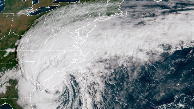
The SSMIS instruments are part of three weather satellites that are in low-Earth orbit and are maintained by NOAA in cooperation with the Department of Defense. They provide critical weather information that can’t yet be replaced by other satellites and weather instruments, according to NOAA.
The SSMIS offers forecasters the ability to examine the inner workings of active tropical systems and to better understand their behavior. Specifically, the tool uses microwaves to penetrate clouds and obtain a clearer picture of the inner structure of a tropical cyclone. This enables forecasters to better monitor the current progress of such storms, including the ability to identify the exact center of the weather system for use in creating forecast models.
Other weather satellites use visible and infrared imagery, which can only capture surface-level details of the cloud tops of such storms, rather than what’s happening inside of them. These satellites also are ineffective after sunset, when it’s too dark to see and when direct observations over open water are scarce. Because the SSMIS system doesn’t have these limitations, forecasters rely on the data it collects during such periods.
Weather forecast models are sensitive to initial weather conditions and rely on multiple sources of accurate weather data for forecasting. Any degradation or discontinuity in the data, whether in terms of quality or quantity, could negatively affect the model’s forecasting skill, scientists warn.
ABC News’ Kyle Reiman contributed to this report.
Copyright © 2025, ABC Audio. All rights reserved.


